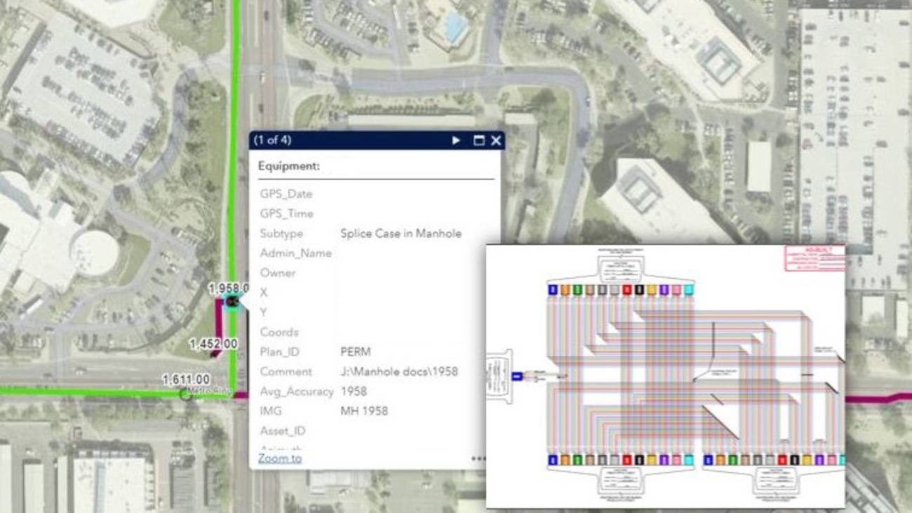
The rapid increase of fiber optic networks demands better documentation and tracking to provide risk assessments, predictive analysis, planning, and action-oriented decision-making abilities. Organizations and agencies realize that creating digital plans via a Geographic Information System (GIS) and, more importantly, keeping the data current is essential to having a single repository to manage and maintain the fiber network properly. Take your digital maps with you, anywhere. Connect your field and office operations by using shared data and keeping real-time data at your fingertips.
- Is your City Smart-City Ready?
- Do you collect and efficiently store the correct information on your City’s Fiber Network?
- Are you able to make good decisions based on the information you currently have about your city?
We have many years of experience assisting cities with better fiber optics network documentation and tracking to provide risk assessments, predictive analysis, planning, and action-oriented decision-making abilities.
The attached white paper explains in detail how BPG can assist you. Feel free to contact us or contact one of our experts directly with any questions you might have.
BPG Designs also offers a spatial GIS-centric, comprehensive yet scalable solution to survey, map and track assets and infrastructure by using a combination of general surveying, mobile LiDAR, static scanners, and UAS’s to perform asset management data collection tasks. This includes everything from striping on roadways to above-ground utilities, tree inventories, signs, poles, pole connections, streetlights, traffic cabinets, buildings, and facility footprints (interior and exterior). Let us assist you in building your Smart City.